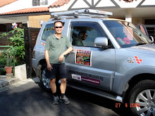
2. Our car had not been properly washed since we started the trip. This time, we really needed to get the car washed, as it looked embarassingly dirty from the previous day's trip to Champasak. With
 the help of the hotel staff we located one in Pakse and after checking out of the hotel proceeded to look for it. We had no regrets. This was the most thorough car wash I had seen in my years of owning a car, in what looked like a service run by the family, parents and kids. With the car parked up the ramp, they used a power jet to wash the whole car, including the under-carriage, vacuumed the inside including every nook and corner, cleaned the seats, blackened the tyres etc, all for US$4. For a while (until it got dirty again, which would be quite soon), our car must be the cleanest car in the province of Champasak.
 3. We spent the morning travelling up the Bolaven Plateau, which was located just to the East of Pakse, to look for a couple of waterfalls. At the height of some 1200 m above sea level, the area is famous for its cool climate, dramatic waterfalls and coffee plantations. It is reputed to produce some of the best coffee beans in the world. At Paksong, which was the main town on the Plateau, we were hoping to visit some coffee tasting outlets (which would have been a very natural thing to do), but were disappointed.
4. Our first stop was Tat Yuang waterfall, a twin waterfall, some 40 m in height. Entrance fee was 5000 kips (less than US$1) per
 person. The waterfall is popular with locals and Thai tourists making short trip from across the border, and there we saw a number of tour buses, probably Thai tour groups. Sunny and I were prepared to take a dip and we brought our swimming trunks. Together with our director chairs, we descended carefully, one step at a time, to the bottom of the waterfall. The steps were made slippery by the spray from the waterfall. Before we reached the b
 ottom, we were already wet. When we did get there, we found that we were the only ones. The rest of the visitors would just stop at the platform midway down the slope to see the waterfall and ha
 d their pictures taken. From this position they could not see the bottom, giving us the feeling that we were entirely on our own. Changing into our trunks, we proceeded to take a dip. This is a chance to see Sunny's golfer legs.
5. Our 2nd stop was Tad Fane Resort and to see Tad Fane waterfall. From the resort, we could see the waterfall plunging some 120 m, a spectacular view. We met 2 new friends there, Tatsuo Fukuoka (a medical student from Japan) and Chow Chin Yee (a Malaysian working in Poypet, Cambodia) who told
 us that it was only possible to see the waterfall from around the midpoint, and it was too dangerous to get to the bottom. In fact, Tatsuo just fell and had to be rescued, and losing some of his belongings. He was backpacking for 9 months, and before reaching Laos was in China and Vietnam. We had a nice chit-chat over a cup of Laos coffee.
6. After the waterfalls, we drove along Highway 16E to Paksong to look for lunch and Laos coffee. As it turned out, there were few eating places along the main road and we decided to try out a
 nice looking hotel on the hill, Pakxong Thevada Hotel, owned by Mdm Guo. We reckoned hotel must have food. We had a good Chinese lunch, almost like home cooked food. Hotel was developed on land leased from the government, and was well located to serve Vietnamese, Thais and Cambodians passing through Southern Laos.
 7. After lunch, we proceeded South along Highway 13 to Ban Nakasang to take a boat ride to Don Det or Det Island. Don Det is located in a area called Si Phan Don or Four Thousand Islands. Located just before the Laos border, it is a cluster of many islands, big and small. Don Det is a major backpacker hangout, and as it expanded the development spilled over to the Don Khon, a bigger island to its South linked by a bridge. Other attractions in the area include more waterfalls and watching of dolphins. Sunny and I thought it would be interesting to have a taste of this popular backpacker hangout on Don Det. We left our car at Ban Nakasang, took a boat to Don Det for a one night stay.
8. Although it was low season, Don Det was already fairly cro
 wded with many young caucasian backpackers. I could not imagine how packed the place would be during peak season. We could see some of them sun tanning at the boat landing area as we were coming in to land.
9. The backpackers go there to chill out, hang around with fellow backpackers, with some cycling around the islands in
 the day. Hotels and guest-houses lined the Northern coast, with supporting amenities like restaurants and a couple of shops providing internet and emails. The main street (if you call it street) is called Sunrise Boulevard.
10. The island is basically bursting at its seam, especially in the North, with the every inch of the Northern coastline taken up by hotels and guesthouses etc. Power was only available between 7 to 11 pm in the rooms, meaning no lights, no fan, no aircon in the room outside this window. And of course, definitely no internet. Think we were the only crazy ones who brought our laptops there.

11. We checked into Little Eden, a small guest house, for US$12 a night. As there was no twin sharing room, Sunny and I took up separate room for the first time since we started the trip. Of course, we slept early. Next morning, did qigong and after
 breakfast hired a bicycle each and cycled to Don Khon after crossing the bridge linking the 2 islands. Tracks were full of stones and pebbles, which made it very hard for the bump. Su
 nny said he had not sweated so much for a very long time.
12. After a quick wash up, we checked out of Little Eden, took a return boat ride and got back to the mainland by about 11 am. Before we crossed the border to Cambodia at about 2 pm, we decided to visit th
 e nearby waterfall at Khon Pha Pheng and eat our lunch there, overlooking the waterfall. We took our barang barang (director chairs, portable stove, maggie mee, sardin etc), and followed a track down to the water not far from the water fall. Sunny did the cooking and we both agreed that the maggie mee had never tasted so good. Near to our spot, a fisherman was fishing with his net, and in less than half an hour must had caught some 7-8 fishes. Of the 3 waterfall
 s we saw in Southern Laos, this is the most spectacular.
 13. After lunch, we took a dip in the water. At about 1.30 we packed our things and were quickly off the road to the Laos/Cambodia at Voen Kham/Dom Kralor and got there at about 2 pm.


