1. May 26, Day 9, we left Duck Lake Lodge at about 10 am for Whitefish, a town not far from West Glacier of the Glacier National Park. Weather was good and it was a scenic drive next to Flathead River with the snow capped mountains in the distance. Along Highway 2 towards Whitefish, we could see that the West side was more developed than the East. There were more accommodation facilities which had just come alive and more recreational facilities (e.g. water slide, children playgrounds etc) which were still closed. In summer, I could imagine that this place would be buzzing with tourists.
2. We checked into Pine Lodge in Whitefish for 2 nights and took the

 afternoon to explore this small beautiful town of about 5000 which is also home to Whitefish Mountain Resort, a ski resort. As we drove around, we could see
  beautiful houses in the hills and around the lake. We suspected many were holiday retreats of the more well-off. Many shops along Central Avenue catered to the needs of tourists. Here we ate in a couple of restaurants that served excellent food. With the ski resort and the Glacier National Park nearby, tourism must had become an important part of the local economy, providing tourism business almost the year round for Whitefish.
3. May 27, Day 10, was a miserable day. It was gloomy, wet and cold. We were not in the mood to over-extend ourselves today. The comfort of the hotel room was just too contrasting. We decided to see the remaining section of the Going to the Sun Road on the West side which was open up to Avalanche, about 15 miles from the entrance. The Warden at the Visitor Center strongly recommended we trekked the Trail of the Cedars and continued to the Avalanche Lake if we have the energy for it. It's 2 miles back and forth, with height gain of 500 ft. We decided that these should be sufficient for the day.
4. We were somewhat disappointed with the drive along Going to the Sun
 Road, probably because we experienced the more scenic ones in the East. Driving with Lake MacDonald on the left, the scenery was largely shielded by the line of tall trees between the road and the lake. At any rate, most things appeared dull with the kind of weather we had. This was one of the better picture taken.
5. We stopped at Sprague Creek to see a cascading waterfall. Picture shows Asian tourists sharing their umbrellas.

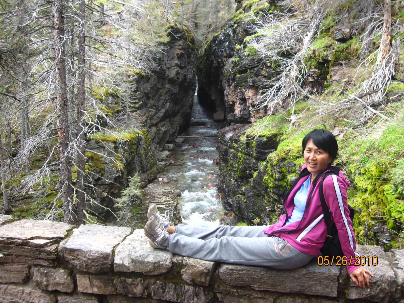
6. Unlike most forested areas, the cedar forest around the cedar trail has not been burnt for more than 500 years, largely because of the dampness of the environment there. In the n
 atural order of
 things, forests are burnt and rejuvenated regularly. As a result, we have here some of the largest cedar trees.
7. It was a pleasant walk among the cedar trees- a certain fragrance of natural wood and sound of running water. The 0.7
 mile wooden boardwalk weaved and turned through the forest, completely accessible to the handicapped.
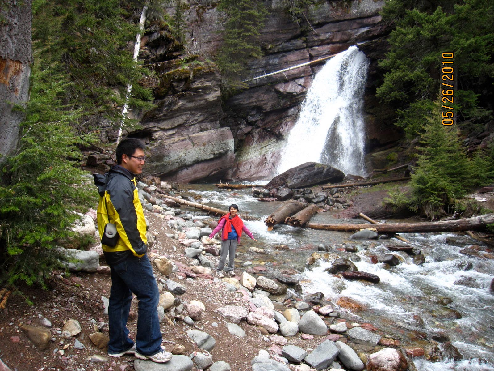
8. At the end of the trail was Avalanche Waterfall.
It's interesting to see how the rocks had been shaped and smoothed by the fast running water over many many years.

9. After Avalanche Waterfall, we started our climb to Lake Avalanche - about 2 mile trek up 500 ft, up hills that were thickly forested by cedar trees. We reckoned it would take us 2-3 hours. The climb was not too hard, although the wet and sometimes muddy tracks ensured that we could not go fast. It

 was a popular trail as many tourists were also making the climb. We were delighted to see some animals along the way, like the deer behind us (which happily continued its meal, ignoring us) and the fast small creature (don't know what it was) which I managed to capture with my camera.

10. We were happy to reach Lake Avalanche (about 3 576 ft high) but we did not loiter there long. If weather was good, it would have been lovely to have a picnic there. But, it was wet and gray though I could visualize its beauty.
11. On the way back, we stopped at Lake MacDonald Lodge for a warm cup of coffee. It's a lovely accommodation facility by the lake. We rushed in and out that we forgot to take a picture of this hotel.
12. With this, we ended our visit to Glacier National Park. Together we spent about 3 days here. It was mostly wet but we had enjoyed the various priceless moments of natural beauty. Some food for thoughts:
(1) A delay of 1-2 weeks may be better - possibly warmer, though weather is really hard to predict, and more facilities would have opened by then, including Going to the Sun Road.
(2) Could combine with the trip to Waterton Lakes National Park of Canada as it is adjacent to Glacier. This should be easy to do. We could not do it this time because Weiping could not leave the country as he was holding a student US visa and was still awaiting for his working visa/permit.
(3) When Going to the Sun Road is open, it may be better to stay West of the National Park, e.g. Whitefish, as there are more facilities there.
13. Our next destination was Yellowstone National Park.